Cartography

Results: 24057


#Item
951Sentient World: Human-Based Procedural Cartography An Experiment in Interative Sketching and Iterative Refining Antonios Liapis1 , Georgios N. Yannakakis1,2 , and Julian Togelius1 1  Center for Computer Games Research

Sentient World: Human-Based Procedural Cartography An Experiment in Interative Sketching and Iterative Refining Antonios Liapis1 , Georgios N. Yannakakis1,2 , and Julian Togelius1 1 Center for Computer Games Research

Add to Reading List

Source URL: antoniosliapis.com

Language: English - Date: 2014-12-01 05:19:04
952Microsoft Word - AutoCarto2012 Submission.doc

Microsoft Word - AutoCarto2012 Submission.doc

Add to Reading List

Source URL: www.cartogis.org

Language: English - Date: 2012-11-06 14:48:07
953CARTOGRAPHIC GUIDELINES ON THE VISUALIZATION OF ATTRIBUTE ACCURACY Michael Leitner Department of Geography and Anthropology Louisiana State University, Baton Rouge, LAemail

CARTOGRAPHIC GUIDELINES ON THE VISUALIZATION OF ATTRIBUTE ACCURACY Michael Leitner Department of Geography and Anthropology Louisiana State University, Baton Rouge, LAemail

Add to Reading List

Source URL: mapcontext.com

Language: English - Date: 2008-08-29 22:33:47
954AN ADVANCED MAPPING SYSTEM FOR THE SOIL CONSERVATION SERVICE C. Gene Johnson U.S. Department of Agriculture AMS is an automated cartographic application that will produce base, topogra phic, soil and interpretive maps re

AN ADVANCED MAPPING SYSTEM FOR THE SOIL CONSERVATION SERVICE C. Gene Johnson U.S. Department of Agriculture AMS is an automated cartographic application that will produce base, topogra phic, soil and interpretive maps re

Add to Reading List

Source URL: mapcontext.com

Language: English - Date: 2008-08-29 22:41:22
955Microsoft Word - Keegan, bio

Microsoft Word - Keegan, bio

Add to Reading List

Source URL: ncgia.ucsb.edu

Language: English - Date: 2015-10-21 13:07:56
956+  Visual Analytics “The purpose of computing is insight, not numbers.” Richard Hamming)

+ Visual Analytics “The purpose of computing is insight, not numbers.” Richard Hamming)

Add to Reading List

Source URL: users.informatik.haw-hamburg.de

Language: English - Date: 2014-06-23 05:26:05
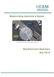
957Modernising Australia’s Datum  Aerial image is used with permission from AEROmetrex Pty. Ltd Questionnaire Summary July 2016

Modernising Australia’s Datum Aerial image is used with permission from AEROmetrex Pty. Ltd Questionnaire Summary July 2016

Add to Reading List

Source URL: www.icsm.gov.au

Language: English - Date: 2016-07-14 20:04:02
958Microsoft Word - size-and-topology_v10-APA 5th ed.docx

Microsoft Word - size-and-topology_v10-APA 5th ed.docx

Add to Reading List

Source URL: www.geovista.psu.edu

Language: English - Date: 2016-07-01 14:44:26
959Cayman Islands Land Info offers a variety of digital topographic map & nautical chart data and satellite imagery products of Cayman Islands including DEMs (Digital Elevation Models), bathymetry and vector layers such as

Cayman Islands Land Info offers a variety of digital topographic map & nautical chart data and satellite imagery products of Cayman Islands including DEMs (Digital Elevation Models), bathymetry and vector layers such as

Add to Reading List

Source URL: www.landinfo.com

Language: English - Date: 2013-08-07 13:09:42
960NED Release Notes December 2006 th The December 2006 release of the National Elevation Dataset (NED) represents the 39 update of the 1-arc-second NED layer since the bi-monthly maintenance schedule began

NED Release Notes December 2006 th The December 2006 release of the National Elevation Dataset (NED) represents the 39 update of the 1-arc-second NED layer since the bi-monthly maintenance schedule began

Add to Reading List

Source URL: nationalmap.gov

Language: English - Date: 2013-10-22 12:06:54