41 | Add to Reading ListSource URL: calval.cr.usgs.govLanguage: English - Date: 2012-04-11 16:12:32
|
|---|
42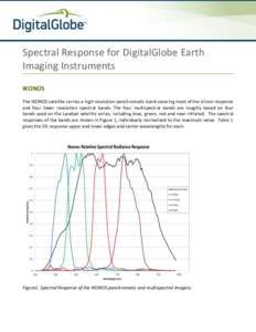 | Add to Reading ListSource URL: www.digitalglobe.comLanguage: English |
|---|
43 | Add to Reading ListSource URL: calval.cr.usgs.govLanguage: English - Date: 2014-04-03 15:18:46
|
|---|
44 | Add to Reading ListSource URL: www.digitalglobe.comLanguage: English |
|---|
45 | Add to Reading ListSource URL: calval.cr.usgs.govLanguage: English - Date: 2012-04-12 12:16:00
|
|---|
46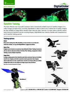 | Add to Reading ListSource URL: www.digitalglobe.comLanguage: English |
|---|
47![Microsoft Word - AAAS-Syria-Hospitals[removed]docx Microsoft Word - AAAS-Syria-Hospitals[removed]docx](https://www.pdfsearch.io/img/44d46dc71cbe24802f83f8b12c7d5da3.jpg) | Add to Reading ListSource URL: www.aaas.orgLanguage: English - Date: 2014-05-14 08:48:20
|
|---|
48![Microsoft PowerPoint - binet.ppt [Compatibility Mode] Microsoft PowerPoint - binet.ppt [Compatibility Mode]](https://www.pdfsearch.io/img/8ab95b7fb04078cbdbf095f56332de20.jpg) | Add to Reading ListSource URL: www.kiss.caltech.eduLanguage: English - Date: 2009-10-29 14:18:08
|
|---|
49![A Preliminary Study on Imaging Time Difference Among Bands of Worldview-2 and Its Potential Applications Jianwei Tao ([removed]) Wenxian Yu Shanghai Jiao Tong University A Preliminary Study on Imaging Time Difference Among Bands of Worldview-2 and Its Potential Applications Jianwei Tao ([removed]) Wenxian Yu Shanghai Jiao Tong University](https://www.pdfsearch.io/img/53d270765f21523653aa82205ce52ca5.jpg) | Add to Reading ListSource URL: calval.cr.usgs.govLanguage: English - Date: 2011-04-13 11:45:33
|
|---|
50 | Add to Reading ListSource URL: calval.cr.usgs.govLanguage: English - Date: 2010-03-30 11:29:33
|
|---|