<--- Back to Details
| First Page | Document Content | |
|---|---|---|
 Date: 2008-10-23 17:30:58Hydrography National Hydrography Dataset NHD Geography Geospatial |
Add to Reading List |
PDF DocumentDocID: 1xRRI - View Document | |
PDF DocumentDocID: 1xGow - View Document | |
PDF DocumentDocID: 1xFNU - View Document | |
DOCX DocumentDocID: 1xDHg - View Document | |
PDF DocumentDocID: 1xz4z - View Document |
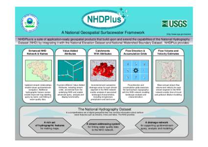
 A National Geospatial Surfacewater Framework (http://www.epa.gov/waters) NHDPlus is a suite of application-ready geospatial products that build upon and extend the capabilities of the National Hydrography Dataset (NHD)