California Geological Survey

Results: 1045


#Item
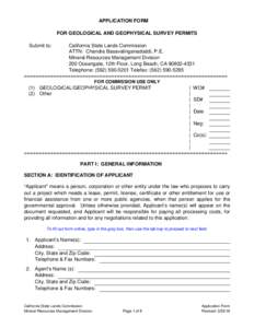
1APPLICATION FORM FOR GEOLOGICAL AND GEOPHYSICAL SURVEY PERMITS Submit to: California State Lands Commission ATTN: Chandra Basavalinganadoddi, P.E.

APPLICATION FORM FOR GEOLOGICAL AND GEOPHYSICAL SURVEY PERMITS Submit to: California State Lands Commission ATTN: Chandra Basavalinganadoddi, P.E.

Add to Reading List

Source URL: www.slc.ca.gov

Language: English - Date: 2018-03-30 11:40:26
    2DOI: s00267Y  Fire Management of California Shrubland Landscapes JON E. KEELEY U.S. Geological Survey

    DOI: s00267Y Fire Management of California Shrubland Landscapes JON E. KEELEY U.S. Geological Survey

    Add to Reading List

    Source URL: www.californiachaparral.com

    Language: English - Date: 2018-08-18 17:14:53
      3Case History NoSanta Clara Valley, California, U.S.A., by Joseph F. Poland, U.S. Geological Survey, Sacramento, California

      Case History NoSanta Clara Valley, California, U.S.A., by Joseph F. Poland, U.S. Geological Survey, Sacramento, California

      Add to Reading List

      Source URL: wwwrcamnl.wr.usgs.gov

      - Date: 2000-03-27 19:58:58
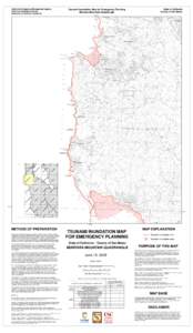
        4California Emergency Management Agency California Geological Survey University of Southern California Tsunami Inundation Map for Emergency Planning Montara Mountain Quadrangle

        California Emergency Management Agency California Geological Survey University of Southern California Tsunami Inundation Map for Emergency Planning Montara Mountain Quadrangle

        Add to Reading List

        Source URL: www.conservation.ca.gov

        - Date: 2015-07-09 19:06:09
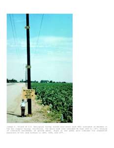
          5Joseph F. Poland of U.S. Geological Survey stands near bench mark S661 southwest of Mendota in the San Joaquin Valley, California. The bench mark site subsided 9m from 1925 to 1977, because of intensive withdrawal of gro

          Joseph F. Poland of U.S. Geological Survey stands near bench mark S661 southwest of Mendota in the San Joaquin Valley, California. The bench mark site subsided 9m from 1925 to 1977, because of intensive withdrawal of gro

          Add to Reading List

          Source URL: wwwrcamnl.wr.usgs.gov

          - Date: 2000-03-27 18:44:58
            6Open Access  Land subsidence in the San Joaquin Valley, California, USA, 2007–2014 M. Sneed and J. T. Brandt US Geological Survey, 6000 J Street, Placer Hall, Sacramento, CA 95819, USA

            Open Access Land subsidence in the San Joaquin Valley, California, USA, 2007–2014 M. Sneed and J. T. Brandt US Geological Survey, 6000 J Street, Placer Hall, Sacramento, CA 95819, USA

            Add to Reading List

            Source URL: www.proc-iahs.net

            - Date: 2016-01-09 07:04:26
              7CALIFORNIA EARTHQUAKE CLEARINGHOUSE After-Action Report: South Napa Earthquake APRIL 17, 2015 Anne Rosinski, California Geological Survey Maggie Ortiz, Earthquake Engineering Research Institute

              CALIFORNIA EARTHQUAKE CLEARINGHOUSE After-Action Report: South Napa Earthquake APRIL 17, 2015 Anne Rosinski, California Geological Survey Maggie Ortiz, Earthquake Engineering Research Institute

              Add to Reading List

              Source URL: www.californiaeqclearinghouse.org

              - Date: 2015-04-17 17:26:53
                8California Earthquake Clearinghouse – 2014 South Napa Earthquake August 26, 2014 Geosciences II Team Members: Jennifer Thornburg and Jeremy Lancaster, California Geological Survey Questions for South Napa Earthquake Fi

                California Earthquake Clearinghouse – 2014 South Napa Earthquake August 26, 2014 Geosciences II Team Members: Jennifer Thornburg and Jeremy Lancaster, California Geological Survey Questions for South Napa Earthquake Fi

                Add to Reading List

                Source URL: www.eqclearinghouse.org

                - Date: 2014-08-27 16:28:05
                  9Natural environment / Physical geography / Geography / Exploration of North America / Geology of the United States / Reston /  Virginia / San Mateo County /  California / United States Geological Survey / Ecosystem services / National Biological Information Infrastructure / Arctic / Environmentalism

                  33rd IGC, International Consortium of Geological Surveys August 11, 2008 An Integrated Strategy for Government-Sponsored Science – Mark Myers Title slide:

                  Add to Reading List

                  Source URL: www2.usgs.gov

                  Language: English - Date: 2008-10-07 12:11:47
                  10The Hydrographic Setting for Mercury Sampling Fish Mercury Concentrations in California Kathy Isham, Jeff Simley The National Hydrography Dataset (NHD) is the surface water component of the The National Map; a cornerston

                  The Hydrographic Setting for Mercury Sampling Fish Mercury Concentrations in California Kathy Isham, Jeff Simley The National Hydrography Dataset (NHD) is the surface water component of the The National Map; a cornerston

                  Add to Reading List

                  Source URL: horizon-systems.com

                  Language: English - Date: 2011-04-05 16:36:18