<--- Back to Details
First PageDocument Content
Cartography / Geography / ArcMap / Contour line / Physical geography / HTML element / Software / Topography / USGS DEM / Terrain cartography
Date: 2015-05-15 12:21:03
Cartography
Geography
ArcMap
Contour line
Physical geography
HTML element
Software
Topography
USGS DEM
Terrain cartography

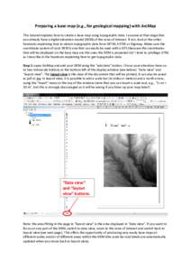
Preparing a base map (e.g., for geological mapping) with ArcMap This tutorial explains how to create a base map using topographic data. I assume at that stage that you already have a digital elevation model (DEM) of the

Add to Reading List

Source URL: www.geos.ed.ac.uk

Download Document from Source Website

File Size: 1,57 MB

Share Document on Facebook

Similar Documents

DIGITAL TERRAIN ANALYSIS STATION (DTAS)  CPT Michael R. Thompson U.S. Army Engineer Topographic Laboratories Ft. Belvoir, VARobert M. Socher

DIGITAL TERRAIN ANALYSIS STATION (DTAS) CPT Michael R. Thompson U.S. Army Engineer Topographic Laboratories Ft. Belvoir, VARobert M. Socher

DocID: 1rqoS - View Document

Preparing a base map (e.g., for geological mapping) with ArcMap This tutorial explains how to create a base map using topographic data. I assume at that stage that you already have a digital elevation model (DEM) of the

Preparing a base map (e.g., for geological mapping) with ArcMap This tutorial explains how to create a base map using topographic data. I assume at that stage that you already have a digital elevation model (DEM) of the

DocID: 1rhwv - View Document

DIGITAL TERRAIN SERVICES AT CHICAGO AERIAL SURVEY  Jerry W. Robinson President 1.

DIGITAL TERRAIN SERVICES AT CHICAGO AERIAL SURVEY Jerry W. Robinson President 1.

DocID: 1raBy - View Document

Read everything before doing anything  GIS Analysts perform spatial analysis when they need to derive new features from existing features. In GIS I, for example, you used the vector approach to derive a riparian buffer (

Read everything before doing anything GIS Analysts perform spatial analysis when they need to derive new features from existing features. In GIS I, for example, you used the vector approach to derive a riparian buffer (

DocID: 1r9R2 - View Document

TOPOGRAPHIC GRAIN AUTOMATED FROM DIGITAL ELEVATION MODELS  ? Richard J. Pike 1 , and William Acevedo  U.S. Geological Survey

TOPOGRAPHIC GRAIN AUTOMATED FROM DIGITAL ELEVATION MODELS ? Richard J. Pike 1 , and William Acevedo U.S. Geological Survey

DocID: 1qXRR - View Document